


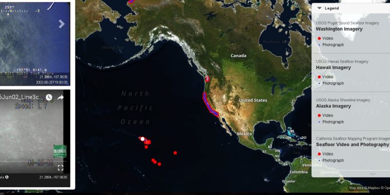
The US Geological Survey (USGS) has a little tool called the Coastal and Marine Video and Photograph Portal, through which you can view some remote and scientifically fascinating regions of the country as easily as you would a street in Google Maps. It’s like a Google Earth, complete with Street View, for the nation’s rich geography regions. When you pull up the map, you can toggle layers of photographs and data, and find specific points of interest along the coastal regions. I was able to “travel” the entirety of the northern Alaskan coast and Hawaiian coasts, looking at coastal reefs…
This story continues at The Next Web
Or just read more coverage about: Google Maps,Google